Craig Rhiwarth hill-fort, Montgomeryshire
Crew, Peter, Guilbert, Graeme, and Roe, David (2012) Craig Rhiwarth hill-fort, Montgomeryshire. In: Britnell, William J., and Silvester, Robert J., (eds.) Reflections on the Past: essays in honour of Frances Lynch. Cambrian Archaeological Association, Welshpool, Wales, UK, pp. 303-336.
![[img]](https://researchonline.jcu.edu.au/23853/3.hassmallThumbnailVersion/23853_Crew_et_al_2012_Cover.jpg)
|
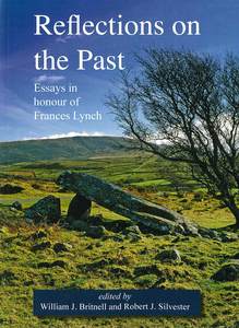
Image (JPEG) (Book Cover)
- Cover Image
Download (756kB) |
|
|
PDF (Published Version)
- Published Version
Restricted to Repository staff only |
Abstract
[Extract] The genesis of this report dates back to 1974, during one of Frances Lynch's memorable student field-trips, when it was suggested to DR that a survey of Craig Rhiwarth would be a suitable topic for his undergraduate thesis, supervised of course by Frances herself. The initial survey was carried out over 10 days during the following spring by DR and PC. Due to the constraints of time and using a plane-table on a site such as Craig Rhiwarth, with its irregular topography, only the central area around the west summit was surveyed, recording 56 structures (Roe 1975). In the summer of 1976, after a spell of very dry weather, the vegetation and peaty soil was burnt off a considerable proportion of the hill-fort, revealing both a large number of new structures and considerable detail within them. Thus, in the spring of 1978, the whole site was resurveyed over a period of 20 days, using a plane-table with a self-reducing alidade. In the days before the common availability of EDM instruments, this was an ideal method for such a site, allowing both the extreme topography to be surveyed with relative ease and individual features, both natural and man-made, to be plotted with considerable accuracy. In April 1978, in a joint project between the Clwyd-Powys Archaeological Trust (CPAT) and University College of North Wales, Bangor (UCNW), Frances and six of her archaeology undergraduates, supervised by GG, made plans of 16 of the burnt structures at a scale of 1:20. This detailed work led to the recovery of a number of artefacts. During 1979 several visits to the site were made by GG, along with Chris Smith of the Ancient Monuments Branch of the Welsh Office (the precursor of Cadw) and officials of the Agricultural Development and Advisory Service (ADAS), to initiate a programme of reseeding of the archaeologically sensitive areas, which had clearly degraded over the previous years. It was during one of these visits that structure CR190 was recognised by GG and the feature was planned and excavated in 1980. A later stage of the project, in 1981, involved the drawing of some of the artefacts by Bangor students, as part of their archaeology practical classes. It is clear from this brief summary of the project that there was cooperation between a range of individuals and institutions, drawing on a variety of resources and softening the often too-rigid boundaries between research, rescue and education. Frances Lynch was closely involved throughout the project and it gives us great pleasure, albeit rather belatedly, to offer this paper to her with thanks for her teaching, her inspiration and her friendship over many years.
| Item ID: | 23853 |
|---|---|
| Item Type: | Book Chapter (Research - B1) |
| ISBN: | 978-0-947846-08-4 |
| Related URLs: | |
| Date Deposited: | 18 Apr 2013 01:42 |
| FoR Codes: | 21 HISTORY AND ARCHAEOLOGY > 2101 Archaeology > 210105 Archaeology of Europe, the Mediterranean and the Levant @ 100% |
| SEO Codes: | 95 CULTURAL UNDERSTANDING > 9505 Understanding Past Societies > 950504 Understanding Europes Past @ 100% |
| Downloads: |
Total: 533 Last 12 Months: 3 |
| More Statistics |


